RELIABILITY OF INTERNET SOURCES IN GEOGRAPHY: CASE STUDY OF MOUNTAINS STUDENA AND ŽARAČKA, SERBIA
DOI:
https://doi.org/10.2298/IJGI1503341LKeywords:
relief, Internet, Mt. Studena, Mt. ŽaračkaAbstract
Jovan Cvijić said that geography is learned on foot. Besides fieldwork, the modern studies imply the usage of various software packages, as well as the data sources available from the Internet. All the data acquired from the Internet need to be carefully checked, unless they are retrieved from the websites of the established formal institutions (Government, Institutes, and Offices). Very often the Internet information may be in the form of data which should be additionally processed by using mathematical and statistics methods. Possibilities for Internet usage will be shown through presentation of the relief characteristics of the mountains Studena and Žaračka, which belong to Kopaonik system. They make a connection between Mt. Goč and Mt. Stolovi in the north and the massif of Mt. Željin and Mt. Kopaonik in the south. Taking into consideration that Mt. Studena and Mt. Žaračka were not previously studied by geographers, this paper is the contribution to the knowledge on these mountains.
Article metrics
References
Andrić, N., Fügenschuh, B., Životić, D., & Cvetković, V. (2015). The thermal history of the Miocene Ibar Basin (Southern Serbia): new constraints from apatite and zircon fission track and vitrinite reflectance data. Geologica Carpathica, 66(1), 37–50. doi:10.1515/geoca-2015-0009
Bogosavljević-Petrović, V. (2006). Continuity of metallurgy in the Ibar valley. Metalurgija, 12(2–3), 129-144. Retrieved from http://www.metalurgija.org.rs/mjom/vol12/No%202-3/5Bogosavljevic.pdf
Bulliqi, Sh., Isufi, F., Kastrati, B., & Jaha, H. (2014). Morphological Features of the Kopaonik Mountain-Part of Kosovo. International Multidisciplinary Scientific GeoConference: SGEM: Surveying Geology & mining Ecology Management 2, 621. doi:10.5593/SGEM2014
Cvijić, J. (1924). Geomorfologija, knj. 1. Beograd: Državna štamparija.
GeolISS (2015). [Geologic Information System of Serbia]. Osnovne geološke karte Srbije. 1:100000. Vrnjci. K34-18. The Ministry of Energy, Development and Enviromental Protection of Republic of Serbia. Retrieved from http://geoliss.mre.gov.rs/OGK/RasterSrbija/
Google Earth (2015). The Studena Mountain. Retrieved from http://www.google.com/earth/download/gep/agree.html
Google Maps (2015). Studena planina. Retrieved from https://www.google.rs/maps/place
Greben (2013). Studena planina. Planinarski klub “Greben”. Mladenovac. Retrieved from http://pkgreben.weebly.com/studena-planina-24112103.html
Jović, V. (2008). The Development of Geology in Serbia. Publications de l'Observatoire Astronomique de Beograd, 85, 113–127. Retrieved from http://publications.aob.rs/85/pdf/113-127.pdf
Kartografija.ba (2015). Kraljevo 530. Srbija. 1:100000 Retrieved from http://www.kartografija.ba/v3/php/menu/karte/tk/tk100/tk100.php
Knezevic, M., Joksimovic, V., & Jovsic, D. (1998). Mineralogical research of the soil and the weathering crust of the Polumir granites (Serbia [Yugoslavia]). Zemljiste i biljka, 47(3), 125–132.
Kovačević, T. (2010). Goč i podgorina. Novi Sad: Univerzitet u Novom Sadu, PMF, Departman za geografiju, turizam i hotelijerstvo.
Kuzmanović, N., Vukojičić, S., Barina, Z., & Lakušić, D. (2013). Sesleria serbica (Poaceae), a neglected species of the Balkan Peninsula. Botanica Serbica, 37(2), 113–120. Retrieved from http://botanicaserbica.bio.bg.ac.rs/arhiva/pdf/2013_37_2_584_full.pdf
Lesić, V., Márton, E., Cvetkov, V., & Tomić, D. (2013). Magnetic anisotropy of Cenozoic igneous rocks from the Vardar zone (Kopaonik area, Serbia). Geophysical Journal International 193, 1182–1197. doi:10.1093/gji/ggt062
Marin, P. D., & Tatić, B. (2001). Serpentine soil and plant diversity, with emphasis on the Balkan Peninsula. Bocconea 13, 145–150. Retrieved from http://147.163.105.223/bocconea/13-145.pdf
Miljković, Lj., & Kovačević, T. (2001). Vrnjačka reka – reljefne karakteristike sliva. Zbornik radova Instituta za geografiju, 31, 14–22. Retrieved from http://www.dgt.uns.ac.rs/zbornik/issue31/02.pdf
Nešić, D., Belij, S. & Milovanović, B. (2009). Mechanism of genesis of sliding block fields on the south slope of Pančić’s peak (2017 m), Kopaonik. Glasnik Srpskog geografskog drustva 89(4), 37–59. doi:10.2298/GSGD0904037N
Obradović, D., & Filipović, D. (2009). Surface and ground water quality analysis on the territory of the city of Kraljevo: The basis for sustainable water resources management. Glasnik Srpskog geografskog drustva, 89(4), 201–224. doi:10.2298/GSGD0904201O
Popović, R. (1999). Sumadija-Kopaonik-Radan-Novo-Brdo Zonundaki (Yugoslavya) Değerli Metaller. Maden Tetkik ve Arama Dergisi 121, 115–123. Retrieved from http://bulletin.mta.gov.tr/mtadergi/121_8.pdf
Ristanović, P. (2006). Centralna Srbija. Fizičko geografska karta 1:250 000. Beograd: Geokarta.
Schefer, S., Egli, D., Missoni, S., Bernoulli, D., Fügenschuh, B., Gawlick, H-J., & Jovanović, D. (2010). Triassic metasediments in the internal Dinarides (Kopaonik area, southern Serbia): stratigraphy, paleogeographic and tectonic significance. Geologica Carpathica 61(2), 89–109. doi:10.2478/v10096-010-0003-6
Schmid, S.M., Bernoulli, D., Fügenschuh, B., Matenco, L., Schefer, S., Schuster, R., Tischler, M. & Ustaszewski, K. (2008). The Alpineà Carpathian-Dinaridic orogenic system: correlation and evolution of tectonic units. Swiss Journal of Geoscience, 101, 139–183. doi:10.1007/s00015-008-1247-3
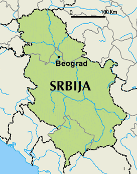
Serbia map (2015). Retrieved from http://www.topnews.in/files/serbia_map.jpg
Stanojević, G. (2012). Analysis of annual sums of precipitation in Serbia. Journal of the Geographical Institute Jovan Cvijic, SASA 62(2), 1–13. doi:10.2298/IJGI1202001S
Tatić, B. (1969). Flora i vegetacija Studene planine kod Kraljeva. Glasnik Botaničkog zavoda i
Bašte Univerziteta u Beogradu, 4(1-4), 27–72. Retrieved from
http://botanicaserbica.bio.bg.ac.rs/arhiva/pdf/1967-1968_4_1-4_116.pdf
Tatić, B., & Veljović, V. (1992). Distribution of serpentinized massives on the Balkan peninsula and their ecology. In The ecology of areas with serpentinized rocks, pp. 199-215. Springer Netherlands. doi:10.1007/978-94-011-3722-5_8
Urošević, M., Pavlović Z., Klisić M., Brković T., Malešević M. & Trifunović S. (1970). Basic Geological Map of the SFRY, 1:100.000. Sheet Vrnjci (K34-18). Beograd: Savezni. Geološki. Zavod; Zavod za. Geološka i. Geofizička. Istraživanja.
Vukov, M. (2014). Intrusive rocks from Polumir and Željin (Serbia): two constrasting granitоid types. Geonauka, 2(3), 1–11. doi:10.14438/gn.2014.16
Vukov, M. S., & Milovanović, D. (2002). The Polumir granite: Addititional data on its origin. Geoloski anali Balkanskoga poluostrva 64, 167–185. doi:10.2298/GABP0264167V
Žeželj (2013). Studena planina. Planinarsko društvo “Žeželj”. Kragujevac. Retrieved from http://www.pdzezelj.org/2013-2/11-05-2013-studena-pl/
Downloads
Published
How to Cite
Issue
Section
License
Copyright (c) 2015 Geographical Institute “Jovan Cvijić” SASA (Serbian Academy of Sciences and Arts)

This work is licensed under a Creative Commons Attribution-NonCommercial-NoDerivatives 4.0 International License.


